
Ever found yourself at the end of a long road trip, looking at your phone and wondering just how much of a dent Google Maps put in your monthly data allowance? You're definitely not the only one.
This guide is here to clear up the confusion, giving you a real-world look at how much data the app actually uses and, more importantly, how you can keep it under control.
Your Guide to Google Maps Data Usage
Think of your mobile data plan like the fuel tank in your car. Every trip you take with Google Maps uses a bit of that fuel. Knowing how much each journey "costs" in data is the key to travelling smarter, helping you dodge those nasty surprise overage fees and making sure you’ve always got a connection when you need it most.
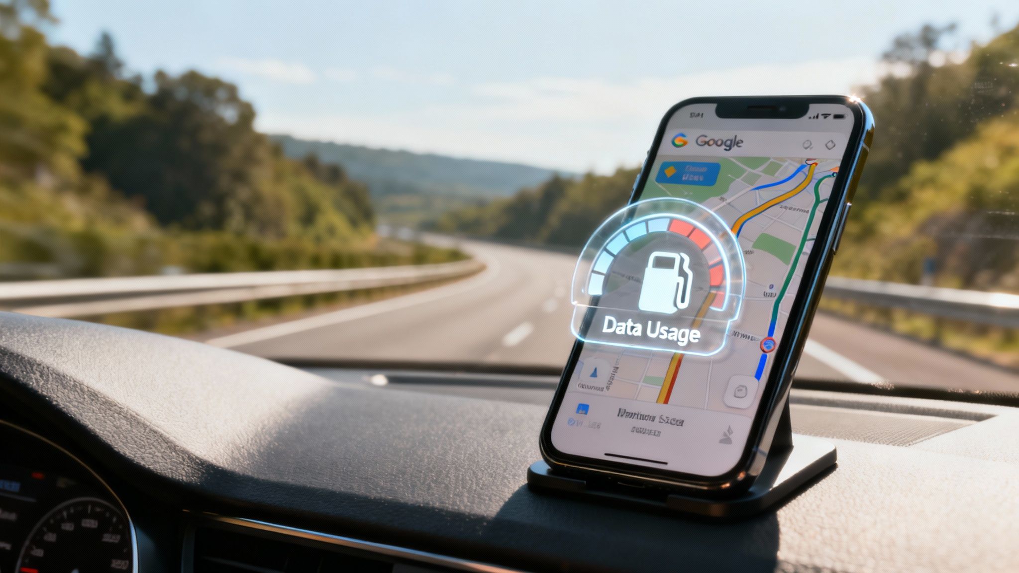
Whether you’re navigating the laneways of a new city or just trying to beat the traffic on your daily commute, a little bit of knowledge goes a long way. On average, you can expect Google Maps to use about 3-5MB of data per hour for basic navigation. That's actually pretty lean compared to streaming music or video.
But—and this is a big but—features like live traffic updates or switching to the satellite view can cause that data usage to climb quite a bit faster.
Why Keeping an Eye on Data Matters
Here in Australia, millions of us fire up Google Maps every single day. It's become second nature. Globally, the app supports over 154 million daily active users, which really shows just how vital it is for getting around.
In bustling city centres like Sydney and Melbourne, usage can skyrocket by as much as 240% during peak hours, which just goes to show how much we rely on it for those critical, in-the-moment decisions. This massive dependency makes understanding its data footprint more important than ever. If you're curious, you can discover more about these Google Maps statistics to get the full picture of its worldwide impact.
To give you a clearer idea, let’s break down what different activities might cost you in data.
Google Maps Data Usage At a Glance
Here’s a quick look at what you can expect from some of the most common activities in the app. The numbers are estimates per hour, but they give you a solid baseline.
| Activity | Estimated Data Usage (Per Hour) |
|---|---|
| Standard Turn-by-Turn Navigation | 3-5 MB |
| Navigation with Live Traffic | 7-10 MB |
| Browsing or Searching on the Map | 5-15 MB |
| Using Satellite View | 15-20+ MB |
As you can see, simply getting from A to B is quite data-efficient. It’s when you start adding layers like live traffic or the visually impressive (but data-hungry) Satellite View that consumption really ramps up.
By understanding these fundamentals, you're already on your way to making smarter choices that keep your data usage in check, all without giving up the features that make Google Maps so incredibly useful.
What Actually Chews Through Your Mobile Data?
To get a real grip on how much data Google Maps is using, it helps to stop thinking of it as a single app. Instead, picture it as a bundle of different services all working together. Each one has its own data appetite, and how you use the app dictates which of those services gets "fed" the most data.

The biggest data consumer, by a long shot, is the map itself. Imagine the entire world map as a gigantic digital quilt, stitched together from millions of tiny square images called map tiles.
Every time you pan across the screen, zoom in for a closer look, or just cruise along your route, Google Maps has to download fresh tiles to show you where you are. The more you move and explore, the more of these little tiles your phone needs to pull down, and that translates directly into data usage.
The Major Data Drivers
Beyond just showing you the map, several key features are constantly whirring away in the background, each adding to your total data bill. Getting to know these is the first step in taming your navigation data.
Here are the main culprits that push your data usage up:
- Live Traffic Updates: This feature is an absolute lifesaver, but it needs a steady trickle of data to work. The app is constantly pinging servers for real-time info on traffic jams, accidents, and general slowdowns to offer you those clever alternative routes. That consistent back-and-forth chatter uses more data than simple navigation.
- Searching for Places: Every time you search for a nearby café, petrol station, or that museum you heard about, the app sends a request and downloads info like opening hours, reviews, and photos. Each search adds a little bit to your data tally.
- Satellite and Street View: These are the heavyweights. Switching over to Satellite View is like going from a simple line drawing to a high-resolution aerial photograph of the landscape. It has to download enormous image files, causing a serious spike in your data consumption.
"Think of standard map view as a blueprint—efficient and light. Satellite view, on the other hand, is like streaming a high-definition documentary of the earth's surface. It's beautiful and detailed, but it comes at a much higher data cost."
Putting It All into Perspective
At the end of the day, any action you take in the app that needs new information from Google's servers is going to use mobile data. While basic turn-by-turn navigation is surprisingly light, it’s all the extra layers of real-time info and high-res imagery that really make the meter spin.
This is why a drive through a busy, constantly changing city with live traffic switched on will use way more data than a straightforward trip down a quiet motorway. By being mindful of which features you’re actually using, you can get a much better handle on how much data Google Maps eats up on your travels.
Ever found yourself wondering why the same drive seems to chew through your mobile data some days and not others? You’re not imagining it. A few key things are happening behind the scenes that can turn a tiny trickle of data into a torrent if you're not paying attention. Google Maps is smart, and it changes how much data it needs based on your specific situation.
Think about the difference between driving through Sydney’s CBD and cruising down a long, straight stretch of the Hume Highway. In the city, the app is constantly checking for traffic jams, accidents, and quicker routes, which means it’s always pulling down new information. That long country drive? Far less data is needed.
Your own habits matter, too. Every time you pinch to zoom in on a side street or drag the map around to see what’s nearby, you’re asking Google to download new, more detailed map sections. It might not seem like much, but those little requests can really add up over a journey.
High-Impact Features That Drain Your Data
While basic turn-by-turn navigation is surprisingly light on data, some of the app’s best features are the thirstiest. They’re like the premium fuel options for your trip – powerful, but they come at a cost. The two biggest offenders are easily Satellite View and Street View, as they have to download high-resolution photos instead of simple map graphics.
Here are the main culprits that can ramp up your data consumption:
- Live Traffic Rerouting: The more your app has to work to find a clever way around a surprise traffic jam, the more data it pulls down.
- Active Searching: When you look for the nearest petrol station or a good spot for lunch mid-trip, the app has to fetch that info in real-time.
- High-Detail Views: Flicking over to Satellite View or diving into Street View downloads massive image files, causing an instant and noticeable spike in data use.
This infographic gives a great visual breakdown of what really influences your data usage.
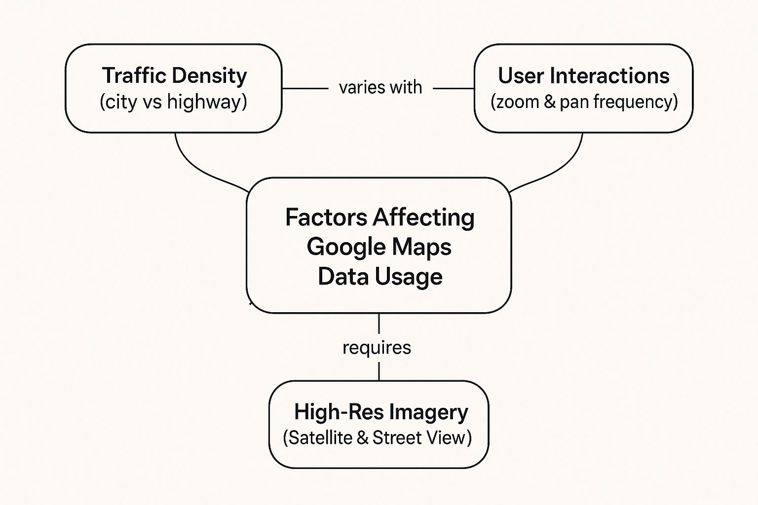
As you can see, it’s the interactive, high-detail features that really make a difference. The more you ask of the map, the more data it’s going to ask for in return.
Real-Time Conditions and Their Data Cost
Google Maps is king in Australia, with around 79.9% of weekly active users firing it up to get around. This popularity means the app is constantly crunching huge amounts of location data to give us those super-accurate, real-time updates we rely on. It’s always talking to GPS satellites—with a location accuracy usually within 20 metres—to deliver precise directions and on-the-fly traffic changes.
The more unpredictable your journey, the more data you’ll use. A straightforward trip requires just a few updates, but a complex drive through the city with ever-changing traffic needs a constant stream of information.
On top of that, some of the more advanced features can add to your data bill without you even realising it. Things like real-time weather overlays and detailed road condition reports are incredibly useful, especially for knowing how to check drive weather conditions before you head off. Just be aware that this extra layer of information comes with a data cost. Once you understand what’s driving your usage, you can start making smarter choices to keep it under control.
Mastering Offline Maps to Slash Data Usage
The single most powerful tool for reining in Google Maps’ data appetite is probably already in your pocket. It’s a brilliant feature called offline maps, which lets you download entire city layouts or huge regional maps directly onto your phone. Think of it as turning your device into a detailed, interactive paper map that works perfectly without an internet connection.
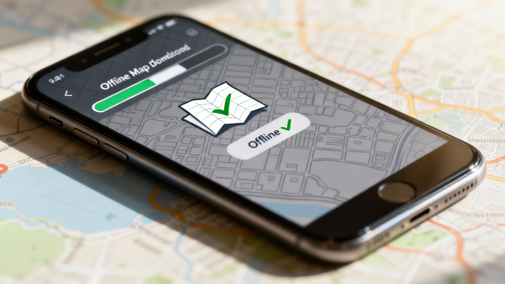
This means you can get full turn-by-turn driving directions, look up streets, and find key landmarks without using a single megabyte of your data plan. It’s an absolute game-changer for international travellers, road-trippers exploring the outback, or anyone who just wants to keep their mobile bill predictable.
How to Download Maps for Offline Use
Getting your maps saved is incredibly simple. The trick is to do it before you leave home, while you’re still connected to a solid Wi-Fi network. This way, you avoid the irony of using mobile data to download the very maps meant to save it.
Here’s a quick rundown of the steps:
- Open Google Maps and make sure you’re logged into your Google account.
- Search for a location, like "Melbourne" or "Sydney CBD".
- Tap the place name at the bottom of the screen to pull up its details.
- Tap the three-dot menu in the top-right corner and choose Download offline map.
- Adjust the map area by pinching and zooming to frame the exact region you need. Google will show you a handy estimate of how much phone storage it will take up.
- Hit Download, and the map will save straight to your device.
Once that’s done, Google Maps will automatically switch to the offline version whenever you’re in that area and have a dodgy or non-existent internet connection. You can navigate with complete peace of mind, knowing you’re not chewing through your data allowance.
For big adventures, like planning a trip to the Grand Canyon from Las Vegas, mastering offline maps is a lifesaver, especially when you hit those remote patches with zero reception.
Understanding the Trade-Offs
While offline maps are fantastic for saving data, they aren't without a few limitations. Because your phone isn't connected to Google's live servers, you do miss out on real-time information.
By going offline, you trade live data for data savings. You'll still get from A to B perfectly, but you won't have the up-to-the-minute information that online mode provides.
So, what's the difference in practice? Here’s a quick comparison of what works and what doesn't when you're offline.
Online Navigation vs Offline Maps
| Feature | Online Mode | Offline Mode |
|---|---|---|
| Turn-by-Turn Driving Directions | ✅ Yes | ✅ Yes |
| Search for Specific Addresses | ✅ Yes | ✅ Yes |
| Live Traffic Updates & Rerouting | ✅ Yes | ❌ No |
| Walking & Public Transport Info | ✅ Yes | ❌ Limited or No |
| Live Business Information | ✅ Yes | ❌ No |
Honestly, this trade-off is often well worth it, particularly on long drives where your route is pretty much set.
Pairing offline maps with other handy tools is the key to a stress-free adventure. If you're looking for ideas, check out this great list of travel apps you should download for your next international trip. A little preparation goes a long way.
Smart Navigation for International Travel
Using Google Maps while travelling overseas can feel like a massive gamble. One wrong turn with data roaming switched on can lead to a shocking phone bill, putting a real damper on your holiday. Too often, travellers are forced to choose between navigating a new city with confidence and saving money, but it really doesn't have to be a trade-off.
Smart planning is the key to exploring new destinations without that financial stress hanging over your head. While offline maps are a fantastic starting point, what happens when you need live traffic updates to dodge a jam, or you want to look up the best-rated cafe nearby? This is where modern connectivity solutions step in, offering an affordable way to stay online.
The Modern Traveller's Connectivity Toolkit
For years, the standard advice was to either hunt down a local SIM card as soon as you landed or hop between dodgy public Wi-Fi hotspots. Both options have their downsides, from language barriers at the phone shop to the very real security risks of unsecured networks. Thankfully, there's a much simpler, more elegant solution today: the travel eSIM.
An eSIM, or embedded SIM, is a digital SIM card that's already built into your phone. It allows you to download and activate a local data plan for your destination country directly from your device, often before you even leave home.
An eSIM gives you the best of both worlds: the affordability of a local data plan combined with the convenience of setting it all up from your phone in minutes. It’s the perfect partner for a data-savvy traveller.
This approach completely changes how you use your phone abroad. You land, turn on your eSIM plan, and you’re instantly connected to a local network at a local price. This eliminates the fear of data roaming and lets you use Google Maps just like you would at home. Whether you need to find your hotel or figure out a complex public transport system, you've got the data to do it.
For those planning a multi-country trip, a dedicated Europe eSIM can keep you connected across the continent with a single, simple plan.
Why an eSIM Beats Other Options
You really can't overstate the value of seamless navigation. In Australia alone, the time-saving benefits of Google Maps are estimated to be worth hundreds of millions of dollars every year. That just shows how much we rely on its real-time data for getting around efficiently. You can discover more about these consumer benefits and see the massive scale of the app's operations for yourself.
By combining the power of pre-downloaded offline maps with an affordable travel eSIM for live updates, you create a powerful and cost-effective navigation system. This hybrid strategy ensures you always have turn-by-turn directions without data, but also gives you the freedom to access live traffic, search for places, and stay connected whenever you need to—all for a predictable, low cost.
Got Questions About Data Usage? We’ve Got Answers.
Let's clear the air on some of the most common questions we hear about how much data Google Maps really uses. Getting straight answers helps you navigate smarter, keep your mobile plan in check, and travel without the dreaded fear of a surprise bill.
We’ve pulled together the top queries and laid out some direct, easy-to-follow answers so you can take back control of your data.
Does Google Maps Use Data When I’m Not Actually Navigating?
Yep, it certainly can, but it’s usually just a tiny amount. If you’ve got "background app refresh" switched on, Google Maps might sip a little data to keep things fresh—like updating your current location or checking nearby traffic—even when you’re not actively using it.
This background use is pretty minimal compared to when you're navigating a route, but those small sips can add up over a month. If you want to stop it completely, just dive into your phone's settings and turn off background app refresh for Google Maps specifically. Easy.
Is Satellite View Heavier on Data Than the Standard Map?
Oh, absolutely. Satellite View is way more data-intensive, and it’s not even a fair fight. It all comes down to how each map is built and sent to your screen.
Think of the standard map as a simple line drawing. It’s made of vector graphics—basically, a set of maths instructions that tell your phone how to draw lines and shapes. It’s incredibly efficient and uses hardly any data.
Satellite View, on the other hand, is like streaming high-resolution photos straight from space. It has to download detailed image files to show you what the world actually looks like, which chews through a massive amount of data in comparison. If you're trying to save data, sticking to the standard map is one of the easiest wins you can get.
How Can I Check How Much Data Google Maps Has Used?
Keeping an eye on your consumption is simple because the tools are already built right into your smartphone. Knowing exactly how much data the app has used can help you understand your habits and make smarter choices.
Here’s how to find the numbers on your device:
- For iPhone users: Head to Settings, then tap on Mobile. Scroll down the list of apps until you find Google Maps. The number you see underneath is its data usage for your current billing cycle.
- For Android users: Go to Settings, then select Network & Internet. From there, choose Mobile network and then App data usage. You’ll see a list of apps with Google Maps among them, showing its total data consumption.
Making a habit of checking this, especially before and after a big trip, is a great move.
Do Offline Maps Expire?
They sure do. Google automatically sets your downloaded maps to expire after about 30 days. This is actually a good thing—it ensures the information you’re relying on doesn't get too stale. Roads change, businesses move, and this policy helps make sure your offline maps stay as accurate and useful as possible.
Don't stress, though. The app will usually ping you with a notification when your maps are about to expire and need an update. It’s always a good idea to connect to Wi-Fi before you head off and refresh any maps you’ve saved. This simple step ensures they are current and ready for your adventure. Understanding what your data plan can handle is also key; for a deeper dive, you can learn more about how far 10GB of mobile data can take you while travelling.
For seamless navigation on your next international trip without the worry of data roaming fees, explore the affordable and convenient travel eSIMs from SimCorner. Get connected in over 200 destinations by visiting https://simcorner.com to find the perfect plan for your adventure.


